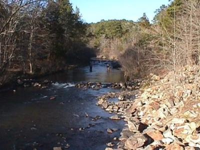
There are four streams in Kansas that bear this name. The first flows in a southeasterly direction through Clark county and empties into the Arkansas river; the second rises in the northern part of Barton county and flows north to the Smoky Hill river; the third flows south across the western part of Smith county and empties into the Solomon river near the town of Gaylord; and the fourth and largest is composed of two forks, one of which rises in Sherman and the other in Cheyenne county. They unite near the town of Atwood, Rawlins county, from which point the main stream follows a northeasterly course and empties into the Republican river at Orleans, Neb.
The ranking score is used to determine how "popular" a trip or location is. It is calculated based off of a weighted average of the number of reviews and the user ratings. For example, a location with 2 reviews and an average rating of 5 will have a lower "ranking score" than one with 10 reviews and an average rating of 4. This is because even though the first location has a better average rating, it has not been reviewed as much as the second location, so it is not as "popular". In the future we may modify the ranking score to take in additional factors, such as the number of views, comments, and photos.
Use the buttons above to view a 3D fly through of this location. The first time you will be required to download the Google Earth Plugin, but it is well worth the effort.
Your Address:
Longitude/Latitude:
-100.5074692, 40.00346375
Birds Eye View:
There is no birds eye view for this location
Use the buttons above to change the the birds eye view orientation for this location. You can also pan around the image to view shoreline and surrounding structure.
Topo Map:
Edit Details:
Are we missing information on Beaver Creek that you know about? Is our data is inaccurate? If so, please Edit This Location.